
Have you ever wondered what our city of Durgapur was like when the dinosaurs used to roam the earth?
We all know that hundreds of millions of years ago, Earth was one large supercontinent. Ever wondered where Durgapur was back then?
ADVERTISEMENT
Well, let’s find out.
A website known as Ancient Earth, developed by software developer Ian Webster, lets you view the location of any place on Earth millions of years ago.
We went through the website and ran the name of our city of Durgapur, and tracked its location from 500 million years ago to the present day.
So let’s have a look:
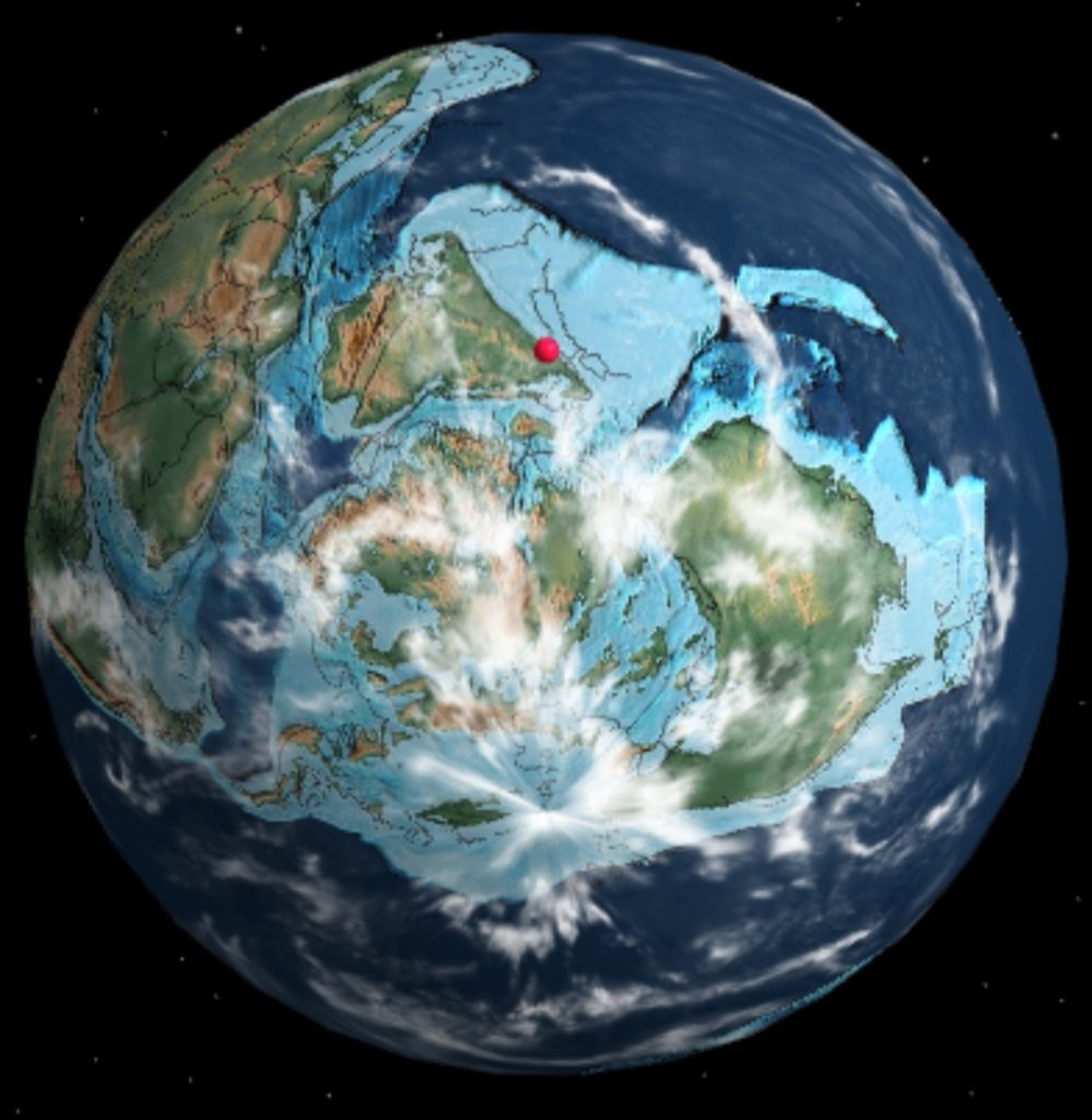
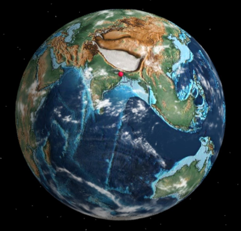
500 Million Years ago
It was a time when the Indian Subcontinent was still attached to the Supercontinent. The Red dot shows the approximate location of present-day Durgapur during that time.
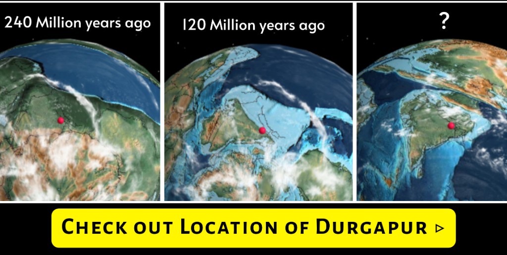
240 Million Years ago
Towards the end of the Palaeozoic era, which ended about 240 million years ago, during the Permian Period, the lower Gondwana land formation happened.
This included the starting of the formation of the present-day Raniganj Coalfields and the Barakar Coalfields.
ADVERTISEMENT
These formations are part of the Damodar Valley Basin.
The Red dot shows the approximate location of present-day Durgapur 240 million years ago.
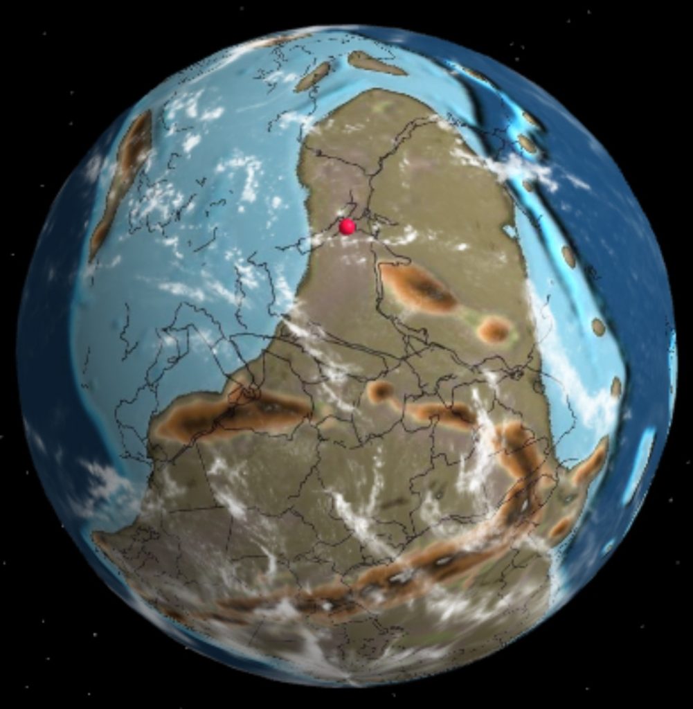
120 Million Years ago
During this time period, major ironstone formation happened in various parts of present-day Bengal and the Damodar basin. The banded iron formation is 50-600 meters thick. They include various iron oxides, iron carbonates, and more.
These banded iron formations are a reliable source of iron to the Durgapur Steel Plant as well as other parts of India and the world.
The red dot in the image above shows the location of present-day Durgapur about 120 million years ago.
ADVERTISEMENT
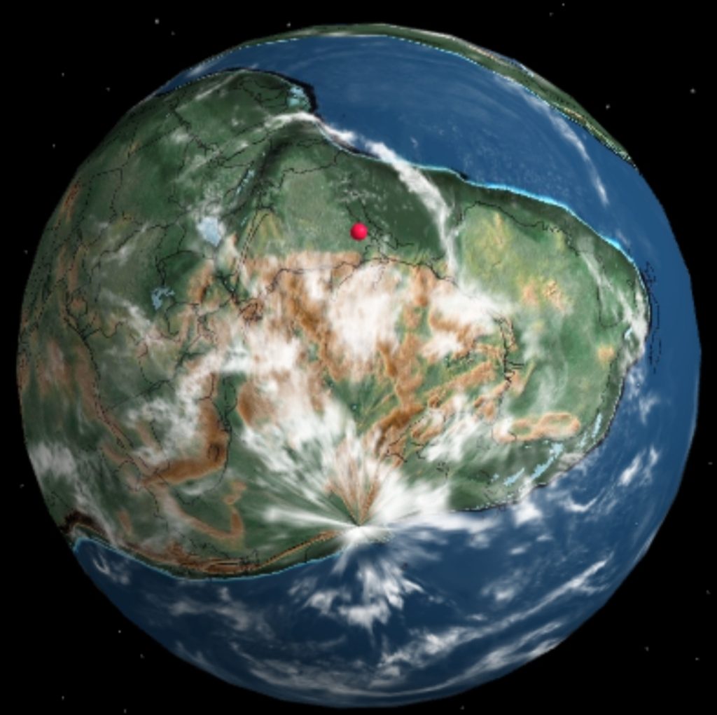
20 Million Years ago
During this period, also known as the tertiary period, the Bengal basin clay, sand, and limestone formation took place. A major change in the sediment formation was noted as a result of the collision of India with the Burma and Tibetan Blocks.
The red dot shows the approximate location of present-day Durgapur during that time when the Indian Sub-Continent collided with Asia.
During this time, the present-day Raniganj Coal field was also fully formed.
It’s astonishing to know how old our planet really is and how the Earth has evolved since its formation.
The website Ancient Globe uses Plate tectonic and paleogeographic maps by C.R. Scotese of the PALEOMAP Project to track the approximate location of various places, millions of years ago.
Found it interesting and informative? Share it with other Durgapurians and let them know.
More about Durgapur
- Durgapur ISKCON Temple – Timings, Location, Occasions
- City Center (Durgapur) – 7 Points You Must Know About
- Bhiringi Kali Temple (Mandir) Durgapur – Timings, History
- 6 Best Parks To Visit In Durgapur (West Bengal)

- 8 Best Places To Visit In Durgapur (West Bengal)

- 7 Best Places For Photography In Durgapur